Monday, April 23, 2012

Graybeard Mountain


Graybeard Mountain – Montreat – 2/25/12 – Felt Like 8 Miles

Each year in late February my church, Avondale Presbyterian, offers a women’s retreat in Montreat, NC, the small community next to Black Mountain whose most famous citizen is Billy Graham.  We take over William Black Lodge, share meals, laughs, a guest speaker for the weekend, maybe some games, and experience a renewing of relationships and an injection of faith into the soul.  On Saturday afternoons some of the women go into Black Mountain for lunch and shopping, and some go hiking up to Lookout Mountain, a lovely scenic spot that isn’t too far in distance but takes some work to get to.  I’ve been to Lookout a few times so I like to go off exploring the other trails around Montreat.

This year I advertised a strenuous hike, and perhaps I didn’t sell it well because I only got one taker, our associate pastor, Jane.  In years past Jane had done a lot of hiking and backpacking, but work duties and life have not allowed room for such things in recent years.  So…what’s it like to spend the afternoon with your pastor?  A gift.

We scavenged food from the snack table and walked down Assembly Drive (aka Graybeard Trail), talking 90 miles an hour, and walked past the trailhead sign.  We ended up in someone’s driveway and turned around.  Story of my life – lost before I start.  In my defense, the roads at Montreat are small and winding, kinda like trails…

Near the trailhead we crossed Flat Creek on a very impressive bridge.  There was a definite chill in the air but a very clear blue sky.  Hats and gloves all day today and keep moving!


Very early in the hike we met a guy wearing a kilt, a bit unusual.  He was a member of the local trail club and his first question was, “Do you have a current map?”  Well, let’s see.  I pulled out my one-page map and indeed it was not the newest edition.  Kind sir produced a new map from somewhere in his pack (not his kilt, I was watching closely) and showed us that the trail had been rerouted with gentle switchbacks.  Hmmm…how much mileage does that add?    Mr. Kilt did not say.  But who cares?  We’re hiking on a spectacular winter day.


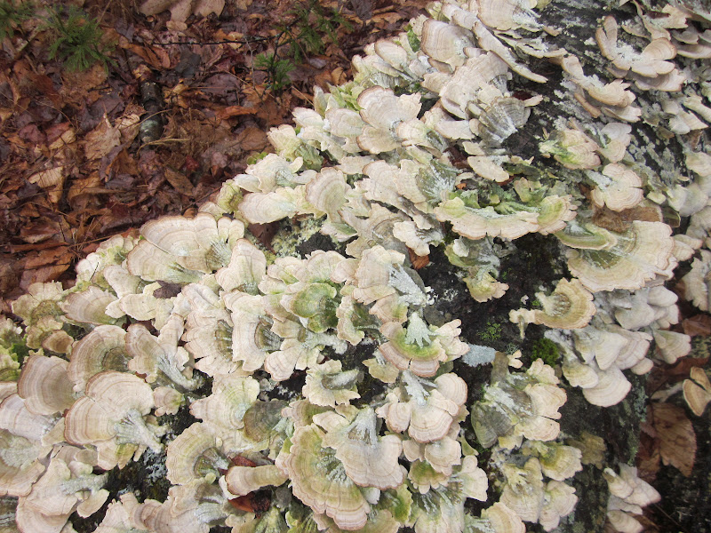
I was delighted to find that Jane is a good person to hike with.  She has an extensive knowledge of plants, identifying emerging foliage, and appreciated stopping to ponder the little things near the ground and overhead.  We were both ready for some nature time and didn’t solve any big theological questions…or did we?  More and more I think that just leaving the questions behind and getting outside in God’s world really is the answer.

The trail was in great shape, as are all the Montreat area trails that I have hiked on (thanks to Mr. Kilt and his trail maintainer friends).  There are sufficient blazes and few obstacles.  We rock hopped across the creek several times and had a good workout on the steep sections and switchbacks.  


We crossed an enormous boulder field and speculated on what it would have been like the day those big rocks tumbled to their resting places.  Huge trees were growing bravely out of narrow cracks.  This little fellow will split the rock someday. 


At Walker’s Knob Shelter we took a snack break.   Looks pretty cozy for a windy or rainy night.

Jane I hiked for several years (hours) on the supposedly 3.5-mile trail toward the summit of Graybeard Mountain, but we finally had to call it quits because of the lateness of the hour.  The compulsive completer in me was very conflicted, but there was no way to tell how far away the summit was.  It could have been 100 yards or another half-mile and we had run out of time.  Didn’t want to miss dinner, after all!  Here we are to prove that we got this far. 

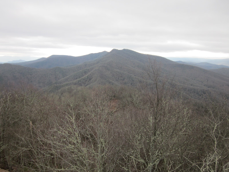
 An awesome view along Graybeard Trail

On the return trip we investigated this quirky tree, a hollow middle that we could see through but lots of “outside”.  Is that a metaphor for a church retreat topic or what?

Icicles dripping along the trail – I told you it was cold

Just a few short steps from one of the switchback turns is Graybeard Falls, trickling today

The walk down was quicker, of course, and we made it back to the William Black Lodge in time for a quick shower and a hot meal.  But, come on, line dancing after dinner?  Well, if you insist...

I love to think of nature as an unlimited broadcasting station, through which God speaks to us every hour, if we will only tune in.  ~George Washington Carver

God writes the gospel not in the Bible alone, but on trees and flowers and clouds and stars.  ~Martin Luther


Thursday, April 19, 2012

Wesser Bald & Cowee Bald

Wesser Bald & Cowee Bald Lookout Towers  – 2/21/12 – 5 Miles

One more night in our cozy cabin and a half-day available for a hike.  Because of time constraints, we chose to hike on the AT to Wesser Bald lookout tower from Tellico Gap.  By trail, you can reach Tellico Gap by continuing northbound (NOBO) on the AT from Wayah Bald for about 10.5 miles.   For us, we chose a long tentative drive on unpaved roads snaking up through the mountains, always fun.

At Tellico Gap we chatted with three hikers that we had passed on our return hike from Wayah Bald yesterday – two were thru-hikers and one was a friend along for the first couple of weeks.  The friend was waiting on her ride back to civilization. 

The temperature was noticeably colder today, more wind, more clouds moving around, but still a great day to be outside – aren’t they all?  Nice trail, good switchbacks – the AT is well maintained here.  Here’s a lovely fern and galax arrangement.


The distance to the tower is listed at 1.9 miles, which we covered in about 35 minutes – can this be right?  We didn’t see anyone on the trail today. 

Wesser Bald Tower is a steel frame platform without a roof, not as solid as the stone Wayah Bald, and we could feel a little swaying going on as we climbed the stairs and marveled at the views in all directions.  The original tower was wooden and the current one once included a live-in cabin, staffed until the ‘60’s.  In the years after that a fire destroyed much of the tower.  In 1993 the wooden observation deck was added to create what we saw today.  When the tower was originally constructed, the peak was a bald but the trees have reclaimed their space.  Peter Barr’s book gives more fascinating information about this historic landmark.


West

North

East

Jim offered the alternative of me continuing on the AT down to the Nantahala Outdoor Center if he hiked back to the car and drove to meet me, a very tempting proposition, but I elected to hike back with him and go look for the Cowee Bald lookout tower from Peter’s book.  I didn’t have a detailed trail map and not a perfect memory of distance or trail conditions – plus the point of the trip was to spend time with Jim. 

I’m glad I declined, learning later that it’s 6.5 miles steeply downhill to the NOC (I was guessing 4 miles) so it would have taken way more time than we had.  A good reminder to not rely on memory alone, but always have a map. 

We took the old jeep road trail from Wesser Bald back down to Tellico Gap, only .9 miles of steepness, and then went in search of the Cowee Bald lookout tower discussed in Peter Barr’s book, cruising back roads, interpreting written directions and the North Carolina Gazateer.  Again we were exploring deep in unpaved territory.  It took more time to find it than we really had to spare, but I was determined to check this one off the list (yes, there is a fire tower “challenge").

Cowee Lookout is not glamorous, sharing a bald with lots of other towers for communi- cations, etc.  The gate was open and we could have driven right up to the foot of the tower, but we elected to walk the half-mile.  The tower has a live-in cabin similar to the one that used to be on Wesser Bald’s tower.   We could only get part way up the steel steps to a locked trap door, so no poking around in the cabin.

A nice view, but I couldn’t pick out all the peaks that Peter lists in his description.

It was a working day for two guys on one of the communication towers, climbing steel rigging like it was nothing (look near the center of the photo).  It must have been cold up there. 

The fire service road via which I intended to make a quick exit was closed, so we had to crawl back the long way down the mountain.  In Franklin we grabbed a quick late lunch at Ms. Lois’ Restaurant (delicious beef vegetable soup, worth a stop). 

Got home in time for my book club’s wine tasting party at 7:00 p.m.  Life is good to me.

"During one of my treks through Afghanistan, we lost our corkscrew. We were compelled to live on food and water for several days."  ~W.C. Fields in "My Little Chickadee"


Tuesday, April 17, 2012

Wayah Bald Lookout Tower

Wayah Bald Fire Tower On the AT – 2/20/12 – 9 Miles

Jim and I played hooky from the world for a few days in the mountains of western North Carolina.  Rain persisted as we kicked around Bryson City for an afternoon until we gave up and retreated to our rental cabin near the teeny tiny town of Almond at the eastern end of Lake Fontana.  After a dreary, rainy, cold night by our cozy fireplace, we drove over to Franklin, NC, passing through the clouds and over the mountain to sunshine and blue skies. 

The goal:  to hike in the Nantahala Mountains on the Appalachian Trail to Wayah Bald lookout tower.  My curiosity was piqued by the book, “Hiking North Carolina’s Lookout Towers” by Peter Barr.  The original wooden tower was built in 1929.  The Civilian Conservation Corps (CCC) replaced it with a stone tower completed in 1937 and it was opened to the public.  The tower served as a fire lookout until 1945.  In the ensuing years renovations were made, including removal of the upper stories and addition of a new roof and interpretive signs to identify the surrounding peaks. 

You can drive all the way to the tower if you want, but what fun is that?  We wanted to hike from the Wilson Lick Ranger Station, about three miles one way.  We drove up, up, up Forest Road 69, and at Wayah Gap the tower road entrance gate was closed  – so now it looks like a 4.2-mile one-way hike with a side trip to the Wilson Lick historical buildings. 

The AT starts off steep here, sucking wind right away, but my breathing was soon regulated.  Jim never breathes hard.  Those cyclists have superhuman lungs… The air was chilly, mid-30’s, but warming with the sun and a cloudless sky and traces of snow on the ground.    

Looking towards Franklin – wonder what the two peaks are?

After the short climb, the trail flattened out a bit and alternated between rolling and uphills, crossing the forest road several times.  We had the trail to ourselves.

Evidence of wild hogs rooting around

Frosty flakes

Wayah Bald tower

Looking out over the wall at the base of the tower

Just a few minutes after we arrived at the tower we heard voices – who else is out here on a Monday morning?  Well, three thru-hikers, of course – two men in shorts and a woman in a skirt.  The woman and one man were a couple, Ma and Pa, and the other man introduced himself as Crash.  The three are not hiking together, just crossing paths.  All had thru-hiked before.  This is Crash’s third time and he will turn 60 on this go-round.  We had a great chat, got a little education on thru-hiking and the fact that repeaters tend to start earlier than first-timers, and that this year was a particularly good one for starting early because of the mild weather.  I asked Crash about his pack, which looked like clear plastic.  It was made of Cuben fiber and weighed less than a pound empty.


So much for our solitude of the morning.  On our return hike we passed 18 other hikers, including 2 more thru’s, some college age kids, and a Boy Scout troop with the leaders bringing up the rear.  The AT is like a highway sometimes, but it was nice to see people out enjoying the beautiful day.

Seemed like we arrived at the side trail to Wilson Lick Ranger Station in no time.  We took a little while to explore the site that once supported the watchmen who worked at the fire tower.  Built in 1916, the remaining buildings are a historical exhibit and not in active service. 


I highly recommend Peter Barr’s book for its background information and hiking routes to fire towers in North Carolina.  Peter is passionate and thorough about his subject.  Maybe you don’t need a reason for hiking, but this book gives a different perspective and new destinations and can lead you to explore areas you may not have thought about. 

If you are seeking creative ideas, go out walking.  Angels whisper to a man when he goes for a walk.  ~Raymond Inmon


Sunday, April 8, 2012

Too Cold To Stop

Richland Balsam and Reinhart Knob – Off Trail + MST – 2/11/12 – 12 miles, 2,770 feet elev. gain

My friend Jeff is helping me with the SB6K challenge.  He has hiked them all but enjoys my company so much that he is willing to repeat the tough ones just to spend time with me.  Or is he keeping his conscience clear so he doesn’t have to read about me in the papers?  Whatever the reason, I am very grateful for his expertise and for the opportunity to hike with him.  Jeff is a savvy hiker, has all the technology, and it’s no secret that I would/have followed him anywhere.  (Note:  after this hike I am adding a few caveats to that.) 

So after all these mild days the weather decided to go all winter-like on us, and our planned hike to conquer Richland Balsam and Reinhart Knob began to look dubious.  The Blue Ridge Parkway was closed and we couldn’t reach our trailhead.  After much phone discussion and internet searching, Jeff found a GPS track that offered an alternative:  an old logging road that would get us within a mile (or two?) of the Mountains–to-Sea Trail and a sort of lollipop route for our two peaks (lollipop = a short trail in, then a loop, then return on the short section again).

Jeff and I live in different cities and we have a regular meetup spot for hiking in western NC.  From there he drove my car (A, I was already tired and, B, it has all-wheel drive, gonna need that) two more hours to our new trailhead, following directions that included “go until blacktop ends, go on gravel, need very good 4-wheel drive, go to flat area at hunters’ camp”.  The rough road wound up and around the mountain and we powered through a few muddy deep ruts until a gate stopped us.   Errbody out, we’re walkin’ from here.  We began trekking about 10:50 a.m. for what we estimated to be an 8-miler.   


The moment we got out of the car the cold grabbed us, sent us scurrying for gloves and hats ASAP.  Our theme for the day was established:  too cold to stop. 

The logging road seemed simple enough for the first 50 yards… and then it split with no way to tell what direction was correct without Jeff’s GPS track.  And then it split again… and again… and again…

Then the usuable part ran out and the road became overgrown, littered with fallen trees of every size and new trees pushing up, sometimes 20 feet tall, but the track was still discernible because it was level.  It paralleled Bearwallow Creek, which was just spectacular with many lovely cascades and mini-waterfalls.  The creek gave an incentive to keep going.  We were basically off-trail now, pushing through thick underbrush and rhododendron and climbing over deadfall.  My hiking poles were a nuisance as I ducked under branches and grabbed onto limbs and rocks with my hands.  A couple of times we tried to leave the logging trail, but the mountainside was very steep and even slower to negotiate.  Traces of snow began to appear.  


We finally turned right to cross the creek and scramble a short way (short being relative), very steep and slow, straight up to the MST, which was thankfully flat and wide.  The bushwhacking wore me out.  I had to stop to eat a tiny Clif bar – running out of energy.  I am not good at eating while walking – no kidding, I can’t chew and swallow and breathe hard at the same time.  But it was too cold to stop for long.  Now snow was an inch deep, melting in some spots, slippery.
The MST utilizes many old logging roads in this neck of Pisgah National Forest 

A side stream trickling/freezing  

Ninja Jeff

The rhododendron say it's too cold to be out here

The MST carried us for several uneventful miles and then we turned right for another uphill bushwhack to the Blue Ridge Parkway - closed to traffic, remember?  We were looking forward to this part, the easy walking and expansive views at the overlooks, but out on the open road the wind was bitter and again it was too cold to stop to enjoy (high 20’s before the wind chill).


We paused oh-so-briefly at Richland Balsam Overlook, the highest point on the BRP.  Jeff pointed out the rock face across the road from the sign and said, “That’s the short way up to the Richland Balsam Trail.” 

And here I go.

Scrambling up, my hiking poles were worse than useless, kept getting caught on rocks.  I was always leaning slightly in so it wasn’t true rock climbing, but definitely scrambling - whew, out of breath at the top.  Then there was the half-mile trail to the summit  - remember, we are here to make a summit, ladies and gentleman - gaining more elevation than I had thought about today. 

I hope this is the summit (nope – but close)

Near the bench I took off my gloves for the world’s quickest bathroom break, then to peel and eat a hardboiled egg and put on outer layers of rain pants and jacket.  In that few minutes my fingers got so cold that I could not feel them.  I had to drop the egg into my pocket and pull on my thickest gloves (I was carrying 3 pairs).  Jeff complained of very cold hands too and we both started moving quickly downhill, almost jogging, and I put my gloved hands inside my jacket pockets and briskly rubbed my stomach trying to warm them up.  One by one my fingers began to tingle on each hand, really hurt like pins and needles.  It took 10 minutes to get to the other end of the Richland Balsam Trail at the parking area and my fingers began to feel normal.  Very scary.  I had the sobering thought that we needed to be extra careful because if one of us got hurt we would be in bad shape in this cold while waiting for help.

From the bottom of Richland Balsam we walked on the Parkway towards Reinhart Knob, but we did not enjoy the easy walk because of blasting cold winds blowing snow around on the road surface, stinging our faces.  Time was getting crucial – nearly 5 p.m. now – was there enough daylight to get back to the car?  Not likely.  We weren’t sure how many miles we had to go.


Using Jeff’s GPS track we scrambled to the summit of Reinhart Knob, a long, tough bushwhack.  The snow was a little deeper.  We both put our cameras away and got serious about finishing this hike.  The summit is covered with trees, no view, no desire to take a picture.  Again my poles were of little use and I briefly debated leaving them behind.  Then on the descent they were marginally helpful. The downhill bushwhack was slippery snow and we were scurrying because of the hour.  I will confess that sliding down in some places on my rain paints was almost fun.  I was increasingly concerned about getting hurt, though.  In hindsight I do wish I had some photos of what we were crawling over, under, around and through – but no time for posing.  Did I mention it was freakin’ cold?

We arrived back at Bearwallow Creek and crossed back over it in the area where we had crossed in the morning, what seemed like a hundred hours ago.  This was our last bad obstacle in the fading light.  We began retracing our steps on the logging “road” – didn’t seem so intimidating now because we knew what those conditions were.  Still, that last mile-and-a-half seemed to drag on as the sky turned pink, then purple, then darker purple.  We were determined not to use head lamps, and we didn’t.  It’s amazing how long daylight seems to hang on with no artificial lights, a slow fade.

Back at the car at nearly 7:00 p.m. – wow – eight hours to complete what turned out to be a 12-mile hike.  We crept back down the rutted road, Jeff driving again, and back on the pavement conditions were icy and the car slid a couple of times.  After an eternity we arrived at our meeting spot, dirty and starving, and after a well-deserved  meal we went our separate ways.  We agreed never to do that particular hike again.  I got home around midnight. 

Later I told a few people about this hike and the reaction was invariably, “That sounds just plain awful.”  Was it?  I’ve done a couple of shorter bushwhack hikes with Jeff in warmer weather and more vegetation where we’ve gotten dirty and scratched.  Hiking is hard physical exertion in any season and I’m not afraid of sweating or breathing hard or being exhausted.  Any marathoner, rock climber, cyclist, whatever, will tell you that his/her sport is physically demanding and the completion of a challenge is exhilarating.  Hiking is the same.  Since we had a successful outcome, of course it was a great, epic hike. 

The added element of the cold was the sketchiest part and we made one careless but big mistake.   With the last-minute changes in routes, neither of us had left a hike plan with anyone.  We were parked on a deserted logging road that likely no one would travel on for days.  I am embarrassed to admit that, but to everyone reading this, please don’t ever hike without leaving a detailed plan with someone and a window of time to call in.  In warmer weather, if one of us got hurt he/she could stay put while the other walked out for help.  In those cold conditions, though, the situation would have been much more serious. 

So…24 out of 40 SB6K peaks done.  What next?


Wednesday, April 4, 2012

Mount Hardy - A Little Bit Lost In Middle Prong Wilderness

Mount Hardy, SB6K, Middle Prong Wilderness – 1/28/12 – 9 miles

Feeling a little restless in the new year without a hiking challenge – well, it looks like I should finish the SB6K.  We are having a mild winter in North Carolina and the Blue Ridge Parkway is still open in most places, so there is no excuse.  Some of the summits I must complete are off-trail bushwhacks and I need some help, but some are pretty simple. 

This was my thinking as I drove towards Mount Hardy on a breezy but beautiful sunny Saturday:  pretty simple. 


Mount Hardy is in the Middle Prong Wilderness, which is bordered on the south by the Blue Ridge Parkway and on the east by Highway 215.  Middle Prong is rugged wilderness where trails are not blazed, but this wasn’t my first rodeo.  I once slogged my way up the Green Mountain Trail to the very intersection with the Mountains-to-Sea Trail at the base of Mount Hardy…but I skipped it then because we were on a different mission.  Another time I passed the same intersection when Danny and I hiked the MST and we took the time to navigate the unmaintained trail to the top of Mount Hardy…only we stopped a couple hundred yards short of the true summit.  Since hikers are honest or there really is no point, I felt the obligation to reach the true summit once and for all to claim this SB6K.

The rules for bagging a SB6K peak include a minimum five-mile hike.  You can bag more than one peak in that five miles, but the five miles is essential.  The shortest way for me to claim Mount Hardy under this guideline was an out-and-back hike on the MST beginning where it crosses Highway 215.  I live too far from the mountains, I thought on the three-hour one-way drive to the trailhead. 

Hiking solo requires preparation.  I left my route with my husband and a time by which he should hear from me.  Middle Prong Wilderness and the next-door Shining Rock Wilderness are pretty popular so I expected to encounter other hikers on a Saturday.  This was a simple in-and-out hike on a trail that I had hiked twice before.  Mine was the only car at the small pull-off at the trailhead.


The trail was wet in many places, temporarily an MST “river”.  The temps were in the 30’s and the wind gusted frequently so my gloves and Liberty hat were essential.  I don’t mind hiking in the cold – no sweating!  As long as you keep moving, it’s easy to stay comfortable just by pushing shirt sleeves up or down, removing or putting on gloves.  I started off with a light step and passed the only white blaze in the Middle Prong Wilderness.

I passed by the meadow where our group camped in June 2009 on a shakedown trip prior to our visit to the Grand Tetons.  Funny, the meadow looks a lot smaller now. 

Thar she blows:  Mount Hardy

Hoarfrost on the trail, so delicate

A great day for shadows.   This is how I entertain myself when I am hiking alone. 

The trail to the summit of Mount Hardy is unmaintained, meaning don’t expect a sign and don’t expect even a trail, but so many people go up there that a path has been worn.  And yes, even some trees have been cut down to make the way easier, but it’s not official.  Imagine a line across the bottom of a page and an upside-down letter Y sitting on it.  The line across is the MST.  I was hiking from left to right and was looking for the left “leg” of the Y, to go the summit at the top of the Y. 

So…I found what I thought was the first side trail (left leg of the Y), blocked by a pile of limbs, which I nimbly stepped over and began to climb.  At the crux of the Y I turned left (theoretically going “up” the Y), and then I came to another intersection.  What’s this?  I wasn’t expecting an intersecting trail.  Both directions looked well worn and neither was ascending.  I stopped to scratch my head, rotated a couple of times, and realized that I wasn’t 100% sure now of the way I had come. 

Well, so much for a simple out-and-back hike.  Now what?  I knew that I should stand still to contemplate – walking while thinking you are lost is not a good idea.  After a good five minutes I made an X on the ground with sticks and turned back the way I thought I had come.  Happily, a couple of minutes of backtracking brought me back to what I knew was the MST.  What I still did not know was if this was a different unmaintained trail, an animal path, or really the summit for Mount Hardy. 

So I continued westbound on the MST, looking at my map for any landmarks.  The trail began to descend steeply.   I looked over my left shoulder and saw Mount Hardy – I was walking away from it.  What?

Soon I passed a trail going off to the right, but no signs.  Checked my map – was this the Green Mountain Trail or Buck Spring Trail?  If it was Green Mountain, then Buck Spring should be coming up fast and I would at last know where I was…well, I knew I was on the MST and I knew I was westbound, but I didn’t know where the Mount Hardy trail was. 

Hope I’m not boring you, but this is an important lesson. 

I kept marching westbound and quickly reached a creek large enough to be on my map, which meant I had altogether missed the Green Mountain Trail and had just passed the Buck Spring Trail, and I was way past the summit trail.  Time to turn around and start looking again.  But I knew that I was not getting off the MST now unless I was very confident that I was in the right place.  My time was narrowing down and I did not want the embarrassment or expense of anyone coming to look for me.  My pride was a little miffed at not summiting Mount Hardy, but “pride goeth before a fall.” 

Back-tracking, I again reached the side trail I had first explored, and traveling from this direction it was instantly familiar as the trail that Danny and I had taken on our incomplete attempt.   What a difference memory is from a different direction!  This was clearly the “right leg” of the inverted Y that I had been looking for.  Again I ascended the side trail, but instead of turning left at the junction, I turned right to go up the Y.  Sure enough, the trail climbed steadily, passing the clear space where I could see Sam Knob and Little Sam, passing the USGS marker which we mistook for the summit before.  I kept following the trail a couple hundred yards further until it simply ended and I knew I was on the highest point.  Here is a photo of myself in thick trees, no view.  You’ll have to trust me. 

Back down a short distance to the clearing with a view of Sam Knob, the warm sun on my back, I sat down on a rock to eat lunch.  Suddenly a roar came over the mountain, a sound so loud that I actually ducked my head, fully expecting a plane to fly over.  The wind gusting through the balsams is different than other trees, incredibly loud.  It sounded like a bear snorting into a microphone.  Of course, once I had that image I didn’t stay long, put my sandwich back in my bag and headed out.  It really spooked me. 

I descended back to the inverted Y junction, confidently turned right, which quickly took me back to the MST (where I had originally gotten confused).  I have a good head and memory for directions, so I won’t make the same mistake here again, but this experience was a lesson in map reading, orienteering, and I really need to use a GPS.
 
On the hike back I met a group of four adults with one little boy and five unleashed dogs.  I asked if the dogs were safe and the owners said yes a bit apologetically.  The boy was probably 2nd grade, extremely chatty, told me his name was River, insisted that he share a snack with me.  Everyone was outfitted very well, including River, who carried his own backpack loaded with a Camelback for water and his own food.  Good job, adults!

An unnamed waterfall glimpsed across a valley on the return MST

Back at my car, a car pulled up as I was changing out of my boots.  A middle-aged couple (yes, I realize I am middle-aged too) got out and asked if there was a trail crossing the road there that they could hike on.  I said yes, want to see a map?  I suggested they go the way I had been since I could verify that it was okay, no obstacles, and I also suggested they hike for a certain amount of time and then turn around.  They were pretty clueless.  And in the time that we stood there chatting, the guy decided it was cold and he didn’t want to go.  And we’re worried about ME getting lost in the wilderness?  Sigh.

Listening to a new compilation CD that my son made for me as a Christmas gift, the drive time home flew by.  Six hours in the car for a nine-mile hike feels like no time at all when you’ve got good music.  

I dream of hiking into my old age. I want to be able even then to pack my load and take off slowly but steadily along the trail. ~Marlyn Doan


Monday, April 2, 2012

Panthertown Valley In A Different Season

Panthertown II with Leida – 1/7/12 – 9 Miles?

It took an entire week into 2012 before I could get to a trailhead, but it was worth the wait.  My good friend Leida is ready for new areas to explore and I had just the place for her…after all, after one visit I am an expert on Panthertown Valley.

The weather forecast was sketchy, always a good sign, and although it was chilly the rain held off for most of the day.  The web of trails in Panthertown is complicated, so rather than give you the turn-by-turn route and trail names, let’s just look at some pictures.

Got to get across here to see Schoolhouse Falls.  Gee, it looks cold.

Leida crossing the icy log because Sharon said, “Oh, it’s fine.”

Schoolhouse Falls, a different season

This icy puddle looks like a topo map, doesn’t it?


The small trail to Warden Falls that we used last time was covered with thick ice, so we looked for an alternate scramble.  I’m sure it’s around here somewhere.  

Apparently Leida will follow me just about anywhere

Chillin’ Warden Falls – a lot more water (and ice) than in November

What goes down must come back up

The map says to look for a steep, faint, unnamed footpath

Yes, I’m sure this is it

We worked very hard to get up this trail, built up some heat and had to strip down to shirt sleeves.  Leida says, don't make me!

Maybe?

Let’s go!

At the top of Little Green Mountain, the view across the valley to Goldspring Ridge (different viewpoint than November)

Log lichen looks like… butterflies

While crossing a pretty creek on the way out, we spotted these incredible icicles

And that’s the story of Leida and Sharon going to Panthertown.  A little rain in the last mile did not dampen our fun.  Y’all come back now, y’hear?