Thursday, May 27, 2010

Mt. Hardy - Or Not

MST – Day 20 – 5/5/10 – Bear Pen Gap to 816 – 14.4 Miles

After the usual commute, today’s hike started from Bear Pen Gap. We retraced our steps on the blue blaze trail back to the MST (believe me, that .6 mile counts). Here the MST is an old road bed with odd rows of massive rocks placed - to keep vehicles off? Then we scrambled up and down several huge earthen berms – to keep mountain bikers off? This would be an attractive trail for mountain bikers.

We checked out Charlie’s Bald and the camping area, where two tents were set up. The occupants were still snoozing until they heard us tramping around. Well, it was after 9:00 a.m. – come on, people, don’t sleep the day away!

  Flower of the day: painted trillium. We were very excited at the first sighting, and still not too jaded by the end of the day when we still found them in clusters along the trail. They are very striking blooms.

We crossed the BRP at about 2.5 miles – so far so good – and entered the Middle Prong Wilderness, so we didn’t expect any more white blazes. Immediately after crossing we stopped for a snack break and met two dayhikers out with a dog. The man said, “Even though I know my dog is friendly, you don’t, so he’s on a leash,” and I really appreciated his trail etiquette. So many other hikers have the attitude that their dog is “special” and exempt from leash regulations.

 I was a bit astonished to meet a hunter in full camouflage with a shotgun. He was hunting turkey, but no luck today, and he didn’t slow down to chat. More than one person has asked me if I am afraid of dangerous people on the trail. While I didn’t consider this guy to be threatening, it made me think twice about hunters outside of deer and bear season (other seasons are longer). Should we be wearing blaze orange all the time in wilderness areas?

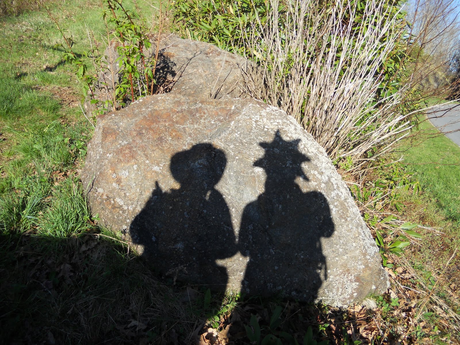
Interesting photos from the day:

Twisted old soldier dead on the battlefield


Great gnarly old tree


Hope you know which way you want to go


Nice grassy straight trail - but not for long


The exposed root system of a recent blowdown


Snake-like coiled wire cable from days past


The real thing this time - the dreaded garter snake

I was intent on summiting Mt. Hardy today as part of the SB6K challenge – after all, I was so close! I felt that Danny was not so keen on the mile side trip, and I told her she could take a long lunch break, but I guess after my episode with the lost camera she was reluctant to “lose” me again. This hike is in her second book, Hiking North Carolina’s Blue Ridge Heritage, and she remember- ed it as a bushwhack (no maintained trail) so she brought some flagging tape. To our pleasant surprise, an easily discernible trail has been made and we only used the tape in a few places. The view from the top showcases Sam’s Knob and Little Sam (the “double top” mountain in the center).

Postscript: We didn’t actually reach the summit of Mt. Hardy after all. We stopped at a metal marker imbedded in a rock, enjoyed the view, and congratulated each other. I saw that the trail continued but I was under the impression that it simply went down the other side of the mountain. My good friend Jeff pointed out to me later that the true summit is a few hundred feet farther with a second metal marker. So…I will be going back to Mt. Hardy someday to bag the peak. Nothing to be disappointed about…just means I get to go hiking again!

Back at the bottom of the Mt. Hardy trail we paused for a well-deserved lunch rest. Just as we were packing up to leave, a man came jogging by wearing trail runners, no pack, no water. He introduced himself as Jim and explained that he was flagging the trail in preparation for the Smoky Mountain Relay Race that was coming through in a couple of days. I’m afraid we didn’t give him much chance to expound on his efforts before we began educating him on wilderness rules (no trail signs), etc. In retrospect I think we were a little hard on him and I’ll try to keep in mind that although we may know a little more than the average person on the trail, we don’t need to share our expertise in every two-minute trail encounter. Sometimes it’s okay to just smile and nod and say “Have a nice day.”

Back on the move: after we passed the Green Mountain Trail intersection I was in familiar territory from my backpack trip with Jeff, Laurie and Ken last summer (a shakedown in preparation for our Grand Tetons trip). Not much registered until we reached the spot where we had resupplied water, but then my memory kicked in as we passed our campsite, crossed Highway 215 and hiked on towards 816.

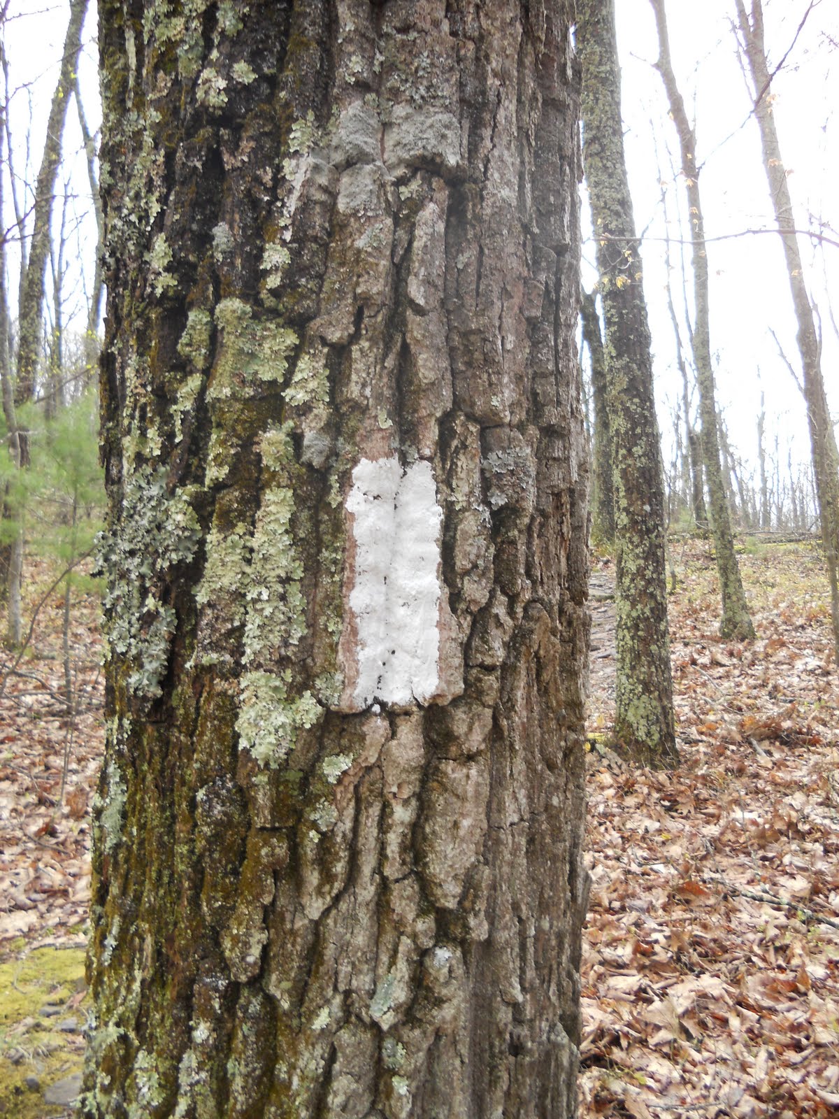
After we crossed 215 the trail character changed significantly – more blazes because we were out of the Middle Prong Wilderness, but the trail seemed stressed, very rocky, rooty, rutted, washed out. Here we also began a four-mile gradual uphill, at times steep. We passed a couple more open fields and one good look at the ominous Devil’s Courthouse.

I have become quite attached to Walt Weber’s detailed route drawings. Although once or twice there have been features that he does not note th
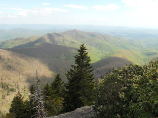
at I feel should be included, overall the maps are excellent for details and figuring out where you are. He notes bridges, switch- backs, outstanding features like “big boulder” and “big funny tree.” But even when you know exactly where you are, the last mile is still always the longest.

One feature that is not specifically noted but is almost impossible to miss is a lookout point to the right just as the MST intersects with the Art Loeb Trail to Shining Rock. After hours of rocks, roots, mountain laurel tunnels, slow uphills and knee- crunching downhills, just one minute in the presence of this grand view and all is forgiven and forgotten. I am so grateful to be able to hike in the mountains.

Read Danny’s version of the hike here.  

I love to think of nature as an unlimited broadcasting station, through which God speaks to us every hour, if we will only tune in. ~George Washington Carver

Tuesday, May 25, 2010

Candid Camera

MST – Day 19 – 5/4/10 – Old Bald to Bear Pen Gap – 13.9 Miles 

After a couple of weeks playing around in other places, Danny and I are back on the MST. An hour-and-a-half commute from her home in Asheville got us onto the trail by about 8:30 a.m.. Who needs sleep anyway? Here we are at Old Bald again.

A quick descent brought us unexpected- ly into lovely meadows with long views southeast. In all of my photos the mountains have the same tilt, so I’m blaming it on the terrain rather than on my holding the camera crooked.

Can't think of a better place to be


I continue to be fascinated by the beauty of bare gray branches and blue sky.


Route finding was challenging early on with unevenly distributed white blazes. We both carry copies of the relevant pages from Scot Ward and Walt Weber’s books and we consulted them often today. We frequently switched from trails to road beds. This section of the MST is rather remote and therefore sees less maintenance and blaze freshening than other sections. The hiking itself was easy with scattered uphills and lots of level strolling. (We would remember this wistfully in a couple of days.)

I made a bet that we wouldn’t see people today – and I lost. Imagine my surprise when we came upon a group with a camp set up. Imagine my increased surprise when Danny speculated that they were a derivation of “Hoods in the Woods,” a backpacking program for youth at risk. No way to know for sure (I wasn’t asking) but the boys had on matching orange hooded sweatshirts. The adults cheerfully said hello, told us there was some “technical” trail ahead, and we kept on moving.


And they were correct as we negotiated rock scrambles and a scant trail clinging to the mountainside.
We crossed nearly two dozen creeks, nothing to get us wet but certainly enough to keep us watchful. Sometimes we would step over two or three small streams and look downhill to where they wove together to form a large gusher just below our crossing point. Props to the trail builders for taking the trail above the confluences and keeping our tootsies dry!


Flower of the day: Wakerobin (not to be confused with Vasey’s trillium, whose flowers hang below the leaves.) We tried many times to get them to smile but this is a difficult flower to photograph. BTW, we also saw Vasey’s trillium in the days following. Their leaves are enormous.

Another head- scratcher mystery camp today and we speculated several scenarios for this setup. Since we crossed so many old road beds, does the Forest Service have vehicle access here and is this one of their campsites? Could it be a hunter’s camp? The MST follows the Parkway and the Parkway’s land is very narrow in places, surrounded by forest land and wilderness where hunting is allowed.

Twisted but still standing


Can you spot Danny through the crazy tree?


Our last mile was a steep, challenging uphill and white blazes were scarce again. Sometimes one person had to wait while the other investigated down a path looking for clues. Without any mishaps, we intersected with a blue blaze trail to the Parkway at Bear Pen Gap Overlook, our ending point for the day.

Danny had been asked to participate in a documentary about the Blue Ridge Parkway’s 75th Anniversary and she arranged to meet Clay Johnson and his cameraman, Jay, from WRAL in Raleigh at Bear Pen Gap. They filmed us more than a half dozen times hiking back and forth along the blue blaze trail, a very interesting process (microphones and everything – watch what you say!) From there we went to the Haywood Jackson Overlook with its great stone picnic table and the long view westward, where we were interviewed on camera. News flash: I am in no danger of becoming a TV personality. I’ve done interviews for newspapers before, but I was surprised at how nervous I was at having my voice and face recorded. I am placing all my hope in the editing fairy that I will not look like an idiot.

The hike and the interview were over but the day was not. Section hiking a linear trail means lots of shuttling to retrieve cars, place a car for tomorrow and then drive down windy old Highway 276. Our reward was dinner at Twin Dragons Chinese buffet , which really hit the spot. And can you believe it: Somebody with a TV camera came in and followed a heavyset woman and a teenage boy around the buffet. Fortunately they didn't get between me and the sweet and sour pork.

Read Danny’s tale of the day here.  

God never made an ugly landscape. All that the sun shines on is beautiful, so long as it is wild. ~John Muir

Monday, May 17, 2010

Hello Dolly!

Dolly Sods Wilderness Hike – 4/24/10 – Red Creek Trail/Little Stonecoal Trail/Dunkenbarger Trail/Big Stonecoal Trail/Red Creek Trail – 7.5 miles

A dreary morning made it hard to get excited at the prospect of a wet hike. Somehow it’s okay if rain begins once you are into a hike, but why is it so hard to start out in the rain? We procrastinated a little in hopes of the weather clearing. Fortunately, although gray was the color of the day our hike stayed dry.

The spectacular drive to the Dolly Sods area built up anticipation for our adventure. Laneville Road’s multiple hairpin turns are similar to the Tail of the Dragon in western North Carolina with the addition of farmsteads and some vacation-type houses.

We followed three cars that looked like they knew where they were headed; consequently we blew past the Red Creek Trail parking area (signs were not visible from the road) and the pavement gave way to rutted gravel. The road became rocky and quite steep, driving reduced to 20 MPH and less. We knew we had gone too far when we reached a parking area for South Prong Trail, so we turned around and headed all the way back down. Red Creek was actually where the pavement ended.

A little history: In 1943 and '44 , the Army used the area as a practice range and maneuver area for training troops for World War II in Europe. Live artillery and mortar shells shot into the area for practice still exist in Dolly Sods.


Our lollipop hike began on Red Creek Trail as a level half-mile walk to the first camping area, where wild confusion broke out. Being a wilderness area, camping is allowed anywhere and there is no signage. There were many worn pathways to campsites. We happened upon a group of two men and one middle school age boy who had just broken camp and were going the same direction. Together we found our way, marked only by a small rock cairn to indicate a faint path left which was Little Stonecoal (no sign, but about right mileage per GPS). This path led to our first crossing of Red Creek. Jim spent quite a bit of time trying to scout a rock-hop across while I waded on through, and he eventually followed.

  The water was… refreshing! As usual I had my Crocs because I hate wet hiking boots. The father of the boy crossed barefoot, dropped his backpack, then went back and piggy-backed the boy across. I asked him why he didn’t use his hiking poles and he wondered the same thing. Methinks the boy needs to learn to cross on his own.

 A steep straight climb up Little Stonecoal Trail followed cascading Stonecoal Creek. Two waterfalls and a half dozen cascades were marked on my trail map, but all were barely visible even through winter trees, so in the summer it’s a scramble off-trail to check them out. We leapfrogged our new friends a couple of times and the trail was sketchy again as we approached the next junction, but we learned that the rock cairns begin appearing near intersections, sort of like painted double blazes that say “pay attention, a change is coming.” A bonus here: there was an actual wooden trail sign at the right turn.
  
The Dunken- barger Trail was very different, weaving through an alpine forest of Eastern hemlock and spruce, young trees, very thick, with no signs of disease like those in North Carolina. Mingled together were large stands of rhododendron and mountain laurel. The footing was very muddy, could have fooled me for a horse trail. There was a Hansel & Gretel feeling all along this trail, closed in and limited sight distance. Campsites along the way were awesome, would be great fun to stay here.

At the next intersection we turned right onto Big Stonecoal Trail and stopped for lunch. We noticed several trees cut off about 1 to 2 feet above the ground with a rough axe chop. Looking around a little bit, we found a big campsite with a huge rock fire pit near a wide creek. I guess that’s where the woodchoppers burned their trees.
Our descent down Big Stonecoal was an exercise in not rolling ankles, lots of rocks and steep elevation. There is no grading in Dolly Sods Wilderness. We passed through huge boulder fields. Can anyone identify the animal poop on this rock cairn?

Jim pointed out that I walked right by this carcass of a young deer – skull, rib cage, fur and lower legs and hooves intact.

At the bottom, another chill thrill crossing of Red Creek


Again head- scratching ensued at the myriad of paths to campsites. Another backpacking group came along (it is not lonely in Dolly Sods) and we checked bearings with them, but we still got off-trail and hit a couple of dead ends before finding the right trail and retracing our steps back to the parking area. Overall, we finished the 7.5 miles in 4.75 hours – not bad for navigating, stopping for breaks and lunch, etc. Although this was not the part of Dolly Sods that I’ve read the most about with balds and bare rock fields, this was a very interesting hike. I’d be happy to return for an overnight trip.

There was not enough time left to check out Seneca Rocks so we took a scenic drive on Highway 72, an even smaller road with even more twists and turns, incredibly picturesque with small farms and little white churches. We ended up in Parsons, which is nothing to write home about, and from there we drove towards Thomas/Davis, passing the wind turbines we had seen on our first day in the area. There also was not enough time to go back to our room in Canaan Valley to change clothes (I told you that nothing is close to anything), so we turned onto a side road and into a cemetery and changed in the car. Don’t laugh, it was very convenient!

Dinner at Muttley’s in Davis, WV – remember, eat local, tip big!  

May you live all the days of your life. ~Jonathan Swift

Saturday, May 15, 2010

Almost Heaven

West Virginia - Blackwater Canyon Rim Bike Ride – 4/23/10 - 22 Miles 

Nearly every year since we’ve been parents Jim and I have taken a weekend to celebrate our anniversary sans kids. The trick was flexibility and not being tied to the actual date. Another requirement was that the destination be within a four-hour drive of either our house or my parents’ house (depending on where the childcare was going on.) But now that the kids are out of the nest, we can go a little farther afield and I have a long list of new destinations. I have always wanted to visit the Dolly Sods Wilderness area of West Virginia and this year we headed for the hills.

Our home-away-from-home was Canaan Valley State Park (pronounced kuh-NANE). West Virginia’s concept of state parks is very different from North Carolina. In WV they are true resorts, lodging, restaurants, swimming pools, movie stars…uh, sorry. We very highly recommend Canaan Valley as a home base for exploring the Potomac Highlands part of WV. It’s cheap, quiet, and peaceful – not close to much, but then again, nothing is close to anything in West-by-God-Virginia.

Jim is an avid road cyclist who often hikes with me, so I am attempting to reciprocate by becoming a cyclist – with baby steps, starting with rail trails. We stopped Friday morning at Highland Prospects, an outfitter in the tiny town of Davis, WV (next door to Hypno Coffee – looked like fun early in the morning). The fellow there gave us good information about the section of the Alleghany Highlands rail trail we were interested in as well as how to find our trailhead for our hike in Dolly Sods the next day. Our bike route was 10 miles downhill from Thomas to Hendricks and then we would see how much farther we felt like going before retracing our path...back UP.
 
At the trailhead, preparing for a bike ride is much more involved than preparing for a hike - front wheels put on, brakes connected, tires pumped up, bike helmets on, water bottles on, spandex adjusted. Where are my sunglasses? And we still had to wear light backpacks with food and rain gear.

The first item of interest on the trail: old coke ovens between Coketon and Douglas. Raw coal was burned in the ovens to produce coke in “beehive” coke ovens. Check out this website for a great explanation of the coal era and the area.

The outfitter guy described a waterfall that we should “get off the bikes and go check out.” I don’t know the name of it, but it was beautiful. The water is a Caribbean aqua and the surrounding rocks are a yellowish color that rubs off on your hands. I was fascinated with one cascade that flowed smoothly into a small crevice, but the photos made no sense without a person for perspective.

The rail trail was extremely rocky and I worried about chipping a tooth . My arms were sore at the end of the day from gripping the handlebars too tightly on the bumpy ride. Pedaling was not necessary, which meant going back up was going to be tough. The trees had not yet leafed out and we caught many glimpses of the Blackwater River far below. The land between the river and the rail trail is privately owned and we also caught glimpses of heavy equipment harvesting the trees.

We stopped at the little pavilion in Hendricks where the trail turned to asphalt – hey, not tired at all! We continued a mile more on the smooth pavement to Hambleton but then decided to turn around because of the time and the climb.

The return trip was really tough for me. I put it in the lowest gear and spun my little heart out. The trail looked flat but moving forward took a Herculean effort. I had to stop about every mile to get off the bike and whimper – it was not pretty. That’s all I have to say about that.

The difference between a cyclist


and a scaredy-cat


We investigated the dozens of coke ovens on the way back – they really are fascinating. Apparently nothing is being done to preserve them and it would be a real shame to lose the evidence of this piece of history. Go see ‘em while you can.

 Back at the car, the reverse of bike preparation – take the bikes apart, retrieve water bottles, etc, and put it all back in the car. Then we checked out Mountainmade, a large shop featuring area artists and craftspeople – very high quality stuff. The building is the original home of the "company store" for Davis Coal & Coke Company (sing it, Ernie!)

 Next we strolled through Davis, looking at the menus of the local restaurants so we could come back into town for dinner. We also chatted with the owner of Blackwater Bikes, the local mountain bike store, telling him about our bike trip. He explained that this section was a “proposed” rail trail, that the only thing that had been done was pulling up the tracks and then everybody started riding on it. That’s why it was so rough. I felt a little better about that. I don’t really want to be a mountain biker, just a rail-trail biker.

Cleaned up, ate dinner at Blackwater Brewing Company, and with some daylight left we investigated Blackwater Falls State Park, another resort area that looked even more inviting than Canaan Valley SP. We walked the extensive boardwalk and steps to view the falls – quite spectacular! Reminded me of High Falls in Dupont State Forest. I forgot my camera, but the website is better anyway.

Tomorrow – Dolly Sods Wilderness!  

The difference between try and triumph is a little umph. ~Author Unknown

AT in VA: Solo Reflection

4/17/10 – AT from Sugar Run Gap to Pearisburg, VA – 10 miles

On Friday, April 16 I joined my younger daughter and 6,000 others in the Run For Remembrance 5K at Virginia Tech, one of my favorite places on the planet. The weather was flawless, the race course wound around campus and through the football stadium, and it was an exhilarating event…if you could forget the reason we were there in the first place. A picnic on the drill field, visiting exhibits around campus commemorating the April 16 tragedy, and a candlelight ceremony at the memorial filled the rest of the day.

 Virginia Tech is only about 35 miles away from Pearisburg, VA and access to the Appalachian Trail, so on Saturday I squeezed in a day on the trail. My daughter was busy so I arranged a shuttle to take me to the trailhead. This was another step out of my comfort zone, combining hiking alone in an unfamiliar place (i.e. outside of those Great Smokies) and relying on a shuttle to get me where I wanted to go. Of course, Neville, shuttle driver and owner of Woods Hole Hostel, met me at the right time and place and showed me where to place my car for the end of my hike. She gave me the history of the hostel as we drove through the valley along Sugar Run Creek. She and her husband, Michael, are living the life the rest of us just play “what if” with over a bottle of wine. Their home/hostel is a dream, an original cabin with an addition and a hiker’s cabin that is an open-air shelter but with electricity and HOT running water for showers. Neville even offers massages and yoga for true trail relaxation. After an extended tour of the place she drove me the last half-mile (which I thought I was going to have to walk) up the mountain to the AT as it crossed gravel road 199. I had to ask her which was trail north – sometimes it’s not obvious!

This flat section of the trail runs through Jefferson National Forest and had just a few blowdowns from the harsh winter (the trail maintainer had already been through). There were clear blue skies above but a cool breeze blowing, so clothing adjustments were constant. Trail builders made good use of the large rocks, creating steps.

My first solo hike since last year felt better than great. My fear of the woods is gone – crackling sounds in the bushes are now interesting rather than scary. No disrespect to my hiking buddies, but the experience of going at my own pace without looking at a watch to time breaks or being aware of someone else’s comfort was freeing. The ease of the terrain probably fooled me into thinking I was Supertrekker, but I didn’t stop as often and didn’t eat as much as when I hike with other people, and I never felt tired.
  
Doc’s Knob Shelter was the first item of interest today. Although it is thru-hiker season, I didn’t expect to find anyone there in the middle of the day, but in the shelter log I read that the fellow who had spent the last couple of days at Woods Hole Hostel had stopped here earlier in the morning.

After Doc’s Knob I entered the longest rhodo- dendron tunnel I’ve ever been in – it felt like a mile. The trail goes on and off of old logging roads, widening and narrowing, and a couple of times those white rectangle blazes were key. Okay, I admit that there was a little bit of climbing after the rhodo tunnel to get to the ridgetop… but after that, I walked along the open forest ridge of Pearis Mountain as the trail skirted the rocky edge. It’s very easy to go off-trail to the right and look over the edge down into Wilburn Valley and Sugar Run Valley. Pearis Mountain is a long, steady ridgeline and since I started near the top the hiking was ridiculously easy.

A shadow passed over me and I looked up and saw giant vultures circling. It felt like a plane had passed silently over – eerie but beautiful.

Eventually the trail goes right up to the rocky cliff-like edge of Pearis Mountain at an unnamed lookout point. Here I stopped for a snack, high above the farms and tiny ribbon of road that strings them together. Spring green was creeping up the mountain and the vultures were gracefully riding the air currents.

About a quarter mile farther, the trail gently threads it way through huge boulders to a lookout point called Angel’s Rest overlooking the New River and the town of Pearisburg. In my humble opinion, the unnamed overlook was more impressive, but I guess Angel’s Rest is a more popular destination for casual dayhikers and the New River gives it more cache.

View from Angel's Rest


From here the AT begins a very, very steep descent. If you want to just hike to Angel’s Rest you’ve got quite a climb. Then the trail changes character drastically with wide, slow switchbacks – different trail building theories? I had to resist cutting straight down, but instead got distracted with the emergence of wildflowers. Obviously I still have a lot to learn about using my latest camera.

My car was parked on Route 634 so I didn’t walk all the way into Bluff City. At the end of my 10 miles I felt as though I could go for 10 more (easy to say when you don’t really have to do it). My long drive home gave me to to reflect - I felt the faint stirrings of a thru-hike somewhere deep down inside, something I've said I have no interest in because of the long time away from home. But...the beautiful weather, the peace of walking alone was very seductive...


Have you ever wandered lonely through the woods?
And everything there feels just as it should
You’re part of the life there, part of something good
If you’ve ever wandered lonely through the woods
~ Brandi Carlile